4:40 p.m. UPDATE:
THIS SYSTEM HAS PRODUCED SOFTBALL-SIZED HAIL.
Meteorologists with the National Weather Service say the storms can be expected to come into the Central Mississippi Area through 7 p.m., and they will continue until around 2 a.m.
The storm moving southeast into the area will be capable of producing very large hail and damaging wind gusts through 7 PM. Similar storms today have produced hail larger than golf balls and widespread wind damage. Get into a sturdy structure, and stay away from windows as this storm moves through.
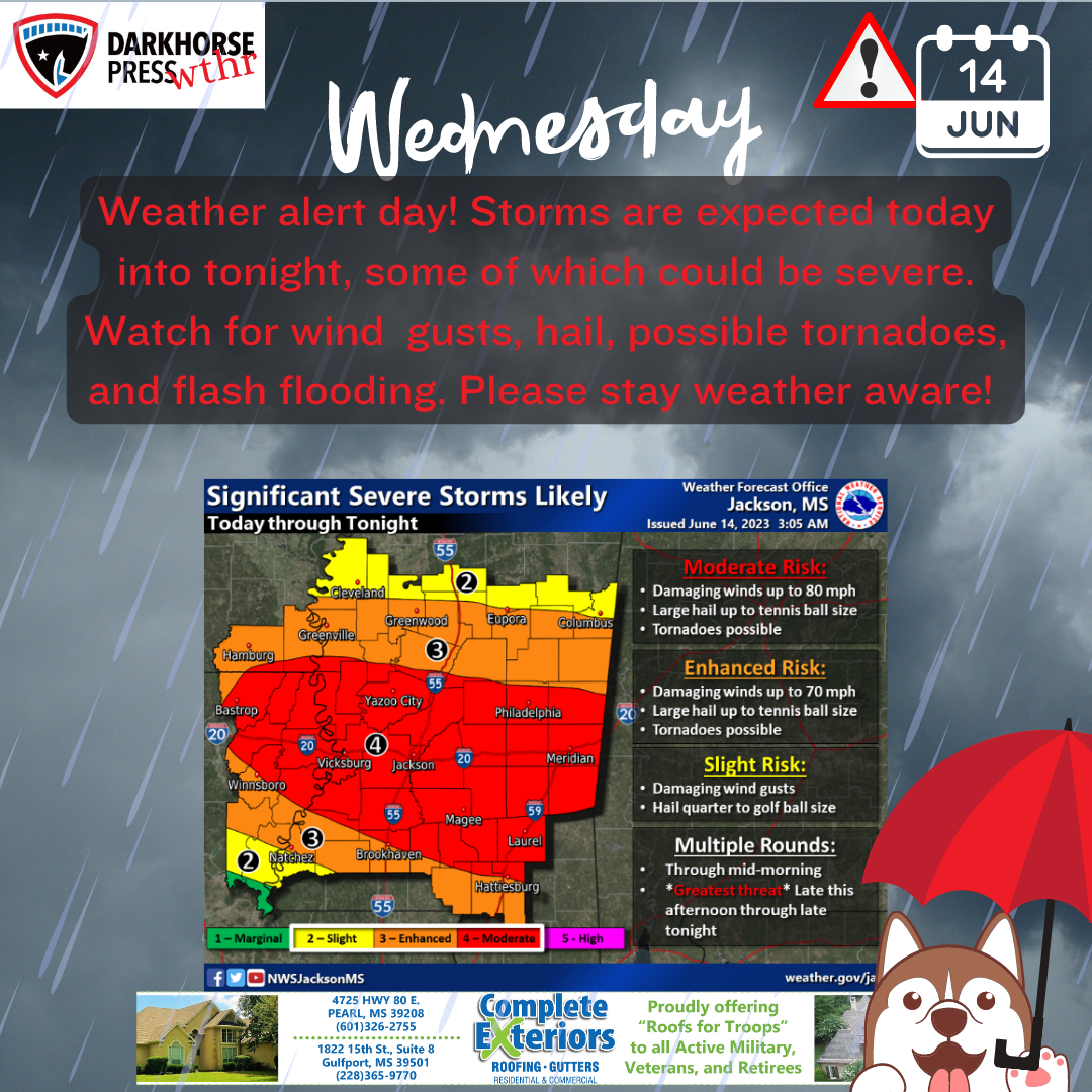
From the National Weather Service: Significant severe storms are likely through tonight. Multiple rounds of storms are expected, including this morning and again late this afternoon through late tonight. Damaging wind gusts up to 80 MPH and hail to the size of tennis balls is possible. Tornadoes are also possible.

Multiple rounds of thunderstorms will lead to areas of flash flooding through tonight. Localized rainfall amounts of 3″ to 5″ are possible. A Flood Watch is in effect for parts of Central Mississippi.

Darkhorse Weather is brought to you by Complete Exteriors.
Specializing in roofing and gutter replacement and repairs, Complete Exteriors is dedicated to bringing you quality service from beginning to end.
Give them a call at 601-326-2755 (Central MS), and 228-365-9770 (Gulf Coast) for your free quote today!