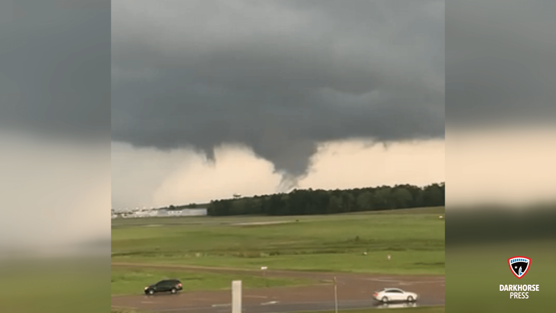
A severe weather event coming into the central portion of the state Tuesday could bring strong and/or long-track tornadoes, according to weather experts.
National Weather Service Meteorologist Dan Byrd said the event should take place late Tuesday into the early overnight hours Wednesday. The Delta should be hit hardest and expect to see damaging winds to 80 mph and strong tornadoes, with long-tracked significant tornadoes possible, and golf ball size hail.
In the metro area, the primary timing for the worst conditions of the severe weather along and just north of the I-20 corridor look to be late afternoon through the early overnight hours, Byrd said. Strong tornadoes with significant tracks are possible, while in areas to the southeast things look to be slightly less dangerous.
Rankin County EOC Director Mike Word said residents in the predicted areas should make certain that they have a 72-hour emergency kit packed in case of damage or power outage. In that kit, he said, should be medications, non-perishable food items, water, important papers, and other things you might need during a period of three days if you’re stranded or without power.
Both Byrd and Word said having a way to get information from the outside world is imperative. Find ways to tune in to your local media, and make sure the emergency alerts on your phone are turned on.
“A NOAA Weather Radio is the best way to be alerted of an impending tornado,” Word said. “Whatever you do, don’t rely on an outdoor siren as your only source — that’s 65-year-old technology. Those are there to alert you to go inside and get information from more updated sources.”
Byrd said weather.gov/jan is a good resource if you have internet access. Rankin County also has an app called “Regroup” that can be accessed through their website.
Word said authorities in Rankin County are currently making preparations as they wait for another weather briefing at 10 a.m. Tuesday. County fire departments are checking their chainsaws, he said, and the road crews, sheriff’s department, and EOC are making sure they have crews ready to go for rescues and assessments.
“It’s really hard to pre-position for something like this because there are 800 square miles in Rankin County, and you’ve got almost a 12-hour window from the NWS,” Word said. “Nailing it down is pretty tough at this point, but hopefully tomorrow we will know more after the briefing at 10. Obviously, everyone needs to stay tuned, stay aware, pay attention.”
Byrd said there is a chance of some isolated flash flooding, but that it is not considered a primary concern.
This weather story is brought to you by Complete Exteriors in Pearl and Gulfport. Let them check your roof for unseen damage after the storm.