Saturday morning update, 10:15 a.m.:
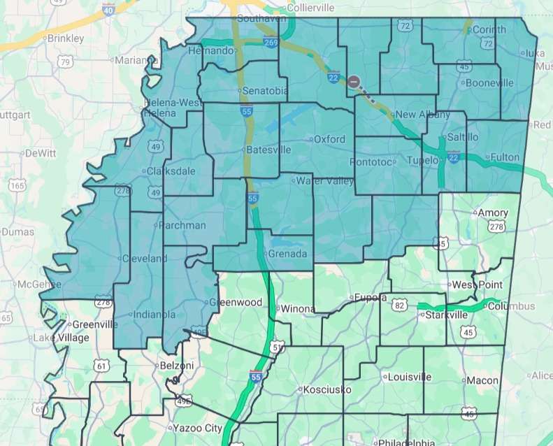 Counties reporting ice as of Saturday morning. Source: MDOT
Dangerous winter weather continued to grip north Mississippi early Saturday as ice covered roads and bridges in at least 25 counties, with conditions expected to deteriorate through the day and into Sunday.
The Mississippi Emergency Management Agency warned that ice, sleet, freezing rain and snow were already falling across north Mississippi Saturday morning and would spread through much of the state by Sunday evening. Travel has become hazardous in many areas, officials said, urging residents to stay home once roads become slick.
 Ice on Jackson Avenue in Oxford. Source: MDOT
“As of this morning, roads and bridges in north Mississippi are already iced over, and conditions are expected to get worse,” MEMA said, advising motorists to avoid travel unless absolutely necessary and to carry emergency supplies in case they become stranded.
The Mississippi Department of Transportation reported ice on roads and bridges as of 7:45 a.m. Saturday in Alcorn, Benton, Bolivar, Calhoun, Chickasaw, Coahoma, DeSoto, Grenada, Itawamba, Lafayette, Lee, Leflore, Marshall, Panola, Pontotoc, Prentiss, Quitman, Sunflower, Tallahatchie, Tate, Tippah, Tishomingo, Tunica, Union and Yalobusha counties.
“All signs point to this only getting worse over the next few hours,” MDOT said, warning that even cautious drivers could lose control on slick roadways.
Power outages are also expected as ice accumulates on trees and power lines, according to MEMA. Residents were urged to have a plan to stay warm if electricity is lost and to prepare for prolonged cold temperatures that are forecast to last into early next week.
The National Weather Service in Jackson said precipitation types could fluctuate Saturday in some areas, particularly in the Golden Triangle region. Forecasters said sleet or light freezing rain may briefly change to plain rain as temperatures rise during the day, before switching back to freezing rain or sleet as temperatures drop again overnight.
Officials encouraged Mississippians to check on family members, neighbors and pets during the storm and to monitor road conditions before traveling. Real-time updates are available through the MDOT Traffic app and at MDOTtraffic.com, which includes live traffic camera views.
Emergency officials said hazardous conditions could persist for several days as subfreezing temperatures keep ice from melting.
Friday evening, original story:
JACKSON — State officials urged Mississippians on Friday to prepare for the slow-moving winter storm expected to bring freezing rain, ice accumulation and potentially widespread power outages over the next several days.
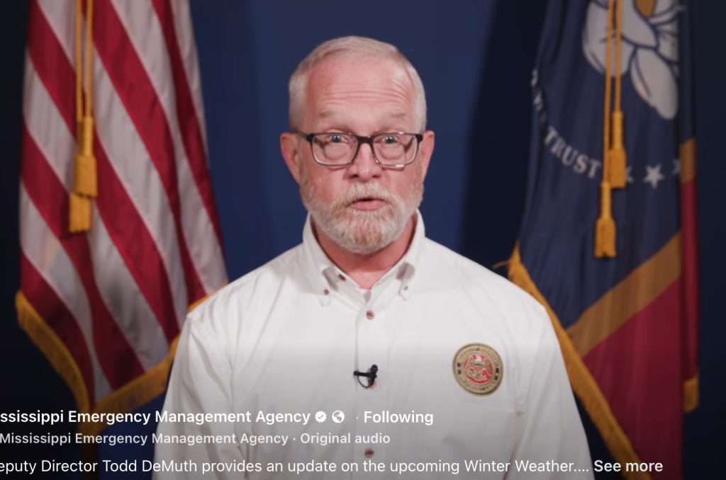 MEMA Deputy Director Todd Demuth updates the public on incoming winter weather.
Gov. Tate Reeves said the storm could affect large portions of the state, with the greatest impacts likely in north Mississippi but dangerous conditions possible as far south as Natchez, Vicksburg and the Jackson area. The earliest ice could develop Friday night in the northwest, with central and eastern parts of the state facing impacts later Saturday or Saturday night.
“This is not a fast-moving system,” Reeves said. “Just because you wake up and don’t see ice doesn’t mean you’re in the clear.”
Reeves declared a state of emergency Thursday, activating the State Emergency Operations Center and allowing officials to pre-position equipment, generators, cots and blankets across Mississippi. State agencies, including the Mississippi Department of Transportation, Department of Public Safety and Mississippi Emergency Management Agency, have been coordinating preparations for several days, he said.
The National Weather Service has issued winter storm warnings for northwestern Mississippi and ice storm warnings for a broad swath of the state, according to MEMA Deputy Director Todd DeMuth. Winter storm watches are in effect elsewhere.
Freezing rain is expected to coat roads, bridges and trees, making travel hazardous and increasing the risk of downed limbs and power lines, DeMuth said. Subfreezing temperatures are forecast to persist for several days after the storm, allowing ice to linger into early next week.
“If roads become slick, stay off them,” DeMuth said. “This is the final day to make preparations to get home before the storm arrives.”
Officials warned that ice storms pose unique challenges because outages and dangerous conditions can last days if temperatures remain below freezing. Reeves said utility crews have staged resources across the state, and priority has been given to placing generators at long-term care facilities.
Several warming shelters are already open, including locations in Grenada County, Yazoo City, Clarksdale and Canton. Additional shelters in Copiah and Adams counties are expected to open Saturday if needed, officials said.
Residents are encouraged to charge cellphones, gather flashlights, blankets and emergency supplies, and plan for possible power loss. MEMA recommends having at least one gallon of water per person per day, nonperishable food and a plan to stay warm without electricity.
Both Reeves and DeMuth emphasized checking on neighbors, family members and vulnerable residents, including the elderly and those with medical needs, and not forgetting pets.
Up-to-date information, preparation tips and shelter listings are available at msema.org. Officials said emergency managers will continue monitoring conditions and adjusting response efforts as the storm unfolds.