Mississippi is dodging a storm experts are calling “unsurvivable.”
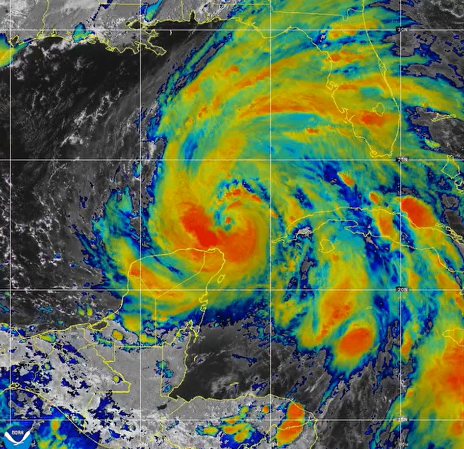
Hurricane Helene is currently considered a very dangerous storm, and it’s set to bring an enormous storm surge to the coast of Florida, as well as storm-force winds and flooding up as far north as Tennessee and South Carolina.
The National Weather Service in Tallahassee described the storm surge threat for Apalachee Bay as “catastrophic and/or potentially unsurvivable” in an update on Wednesday. Wind speedscould reach at least 130 mph by Thursday afternoon, but the National Hurricane Center says “additional strengthening is possible” before landfall.
Even though we’re late in the recognized hurricane seasons, forecasters say conditions are still good for the storms because the waters in the Atlantic are still so warm.
The National Hurricane Center issued the following warning in regard to Helene and the power she’s packing:
“A catastrophic and deadly storm surge is likely along portions of the Florida Big Bend coast, where inundation could reach as high as 20 feet above ground level, along with destructive waves. Preparations to protect life and property should be completed by early Thursday before tropical storm conditions arrive.”
Retired Mississippi Emergency Management Director Robert Latham, who was at the agency’s helm during Hurricane Katrina, posted to his Facebook Wednesday night.
”Hurricane Helene is forecasted to make landfall in the big bend area of Florida as a Cat 4 hurricane or larger. This is likely to be catastrophic with storm surge in excess of 20’ in places. Please pray for the citizens of Florida as well as emergency personnel who are preparing for the aftermath. I pray that everyone is evacuating as directed. You cannot and will not survive a storm like this.”
Here in the Magnolia State, we’ve been watching it closely, but the most Helene is expected to bring us is a little rain and some overcast skies.
National Weather Service Meteorologist Kendall Parks said Mississippi will see an increase in cloud cover and some showers and storms in the northern part of the state starting Wednesday night and potentially running through next weekend. In central and south Mississippi, we’ll see a temperature drop for a day or two and some cloud cover.
Depending on the rain and the cloudy skies, the high Friday could be in the 60s, Parks said, but it will build back up to the mid 80s next week.
Dan Brown #Hurricane Specialist Branch Chief talks about #HurricaneHelene and the impacts affecting #Florida and…
Posted by NOAA NWS National Hurricane Center on Wednesday, September 25, 2024